(long report: First three paragraphs give the basics)
This is the hardest ride I’ve ever done. Gran Fondo Leavenworth (http://rideviciouscycle.com/events/gran ... avenworth/) is around 150km with around 2700 meters of climbing. A little over half the course is on gravel/dirt (Forest Service roads). There are three big climbs—all off-pavement. There’s also about a 15km stretch along the Columbia River which is on pavement and subject to heavy wind.
It’s a well-run, if no frills, event. No one is going to repair a flat for you or bring you a wheel, but the three aid stations were well stocked and staffed with friendly people who offered to fill water bottles, etc. One guy even shared home-roasted coffee from his personal thermos. We were allowed a drop bag, which was delivered to the second aid station.
The Strava profile for my ride is here: https://www.strava.com/activities/585071393
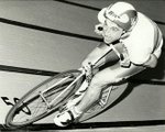
We started at an elementary school outside of Leavenworth. It was interesting walking around the parking lot looking at all the different bikes. Most bikes were CX, but there were lots of mountain bikes too—mostly hardtail 29ers. One couple stood out on their tandem mountain bike (they were awesome). I was on my new Specialized Diverge Comp DSW (basically a Roubaix with disc brakes and wide tire clearance). Tires were something of an obsession. I wish I’d spent more time checking out tires in the pre-race, but I think what I saw ranged from about 32mm up to 2 inches, mostly with knobs. I was using Clement XPLOR USH 35mm tires. http://clementcycling.com/ush Tire pressures (I surveyed some people) ranged all over the map (I went with 40psi in the front and 50 in the back). Because of the varied terrain (substantial gravel and substantial pavement) each bike/tire/pressure choice was a compromise.
The ride started with a neutral rollout for the first few km—all on pavement. We gained a fair bit of elevation at a modest pace during the neutral start. Then we were set loose on the gravel and the first big climb—880 meters of climbing at a 5% average gradient that got quite a bit steeper towards the top. My plan was to take it easy on the first climb. I’d heard stories of people blowing up on the final climb, and figured I’d want some gas left in the tank. It’s always tempting to go with the first group, especially when it’s big like it was for this ride (“If they can do it, I can!”). The thing that forced me to implement my plan was that I’d forgotten my sweatband and was rapidly going blind due to salt in my eyes. I pulled to the side, took off an arm warmer, and fashioned a sunshade/sweatband out of it. It looked goofy but did the trick, and it put me in the middle of the pack no longer worrying about chasing the front. I just found a sustainable pace and stuck with it until about an hour into the climb when I reached the top. A cold wind was gusting at the top and I rapidly lost most feeling in my fingers.
The descent was a bit sketchy. Not as bad as descending Butler Main into Sooke, but lots of loose gravel and some sharp bends and some steep (12%+) sections. I don't like descending on gravel—I’m not a natural mountain biker and tend to tense up and ride the brakes. I knew descents would be my Achilles heel on this ride, but I just took it easy. Tons of people passed me on the descent, but I figured I’d catch a lot of them on future ascents. I hate being passed, but I hate gravel rash more, so that kept my speed in check. By the time I reached the bottom of the first climb (and Aid Station 1), I was looking forward to the next ascent. At least I wouldn’t be constantly worried about crashing!
We were back on pavement for a little more descending (buttery pavement feels so great after descending on gravel!), and then we turned up again, first on pavement, but soon on gravel. The second ascent is shorter and lower gradient—much tamer than the first. It’s also through some beautiful country. Meandering streams, pine forests, Okanagan-like scenes. Someone told me it was their favourite stretch of the ride, and I’d agree. The descent was interesting. The top half is quite steep and the road was badly rutted near the top. These were wheel eaters: 30cm across and 30cm deep in spots. They veered all over the road, so they were hard to miss in places; you just had to pick your way over them at the narrower bits and keep your wheel as close to 90 degrees as possible. The side of the road near the top was littered with people with flats. Each of the first few bends had 2-3 people changing tires. I felt vindicated in my decision to take it easy descending. The time I was losing through caution was nothing compared to the time of changing a tire (at least the time it takes *me* to change a tire!).
We reached the bottom, hit pavement, and soon reached Highway 97, along the Columbia River. This was approximately the halfway point of the ride in terms of distance. We were 3 hours and 40 minutes in. Here we were blasted by wind. Fortunately there were around seven of us in close proximity and soon we formed a little paceline and started hammering along toward Aid Station 2. Many people had to do this segment solo and said it was demoralizing—so it was great to have others to do it with. Among them was Kyle Denny of Victoria Wheelers. We dropped one or two people, picked up one or two more, and eventually reached the aid station. Here I came across Blair Phelps—my training partner (along with Kenji Jackson) for this ride. Blair declared this “The best aid station ever” based on the assortment of goodies. Blair waited a bit for me and Kyle to slap on some sunscreen and refill bottles and soon the three of us rolled out toward the final climb (back over the first pass).
The ride up Entiat River Road was paved but demoralizing due to wind and the 1% incline. We were slowly closing the gap on a group of about 5 ahead of us. Would have been lovely to team up with them to battle the wind, but we also needed to conserve energy for the big gravel climb ahead. And there would be no draft on the big climb or the following descent, so it wasn’t worth burning matches in an attempt to catch them. We slogged along on our own until we reached Aid Station 3 (what had been Aid Station 1) at the base of the final climb.
The final climb was just the reverse of the first climb. This was a last minute course change, due to the originally planned final pass being a mudpit and inaccessible to support vehicles after a recent thunderstorm. Blair had missed the announcement that we’d be retracing the first ascent. He said, “As we were descending this earlier today, I thought, ‘I’m glad we don’t have to come back up this way!’” There Blair—your anti-wish came true!
The climb was gruelling. I knew my tank was running low. My legs were protesting things they normally cope fine with. The average gradient over the next 11 kms was 7%. Around the middle of the ascent things steepened to 12%. Keep in mind we’re on loose gravel. Wheels began spinning out, people teetered on their bikes, and suddenly we started to see walkers.
The psychology here got interesting for me. I’m not normally the sort of person to beat up on someone for quitting. But I really resented the walkers. I found myself cursing them in my head and trying not to look at them as I rode past. Each one of them represented this enormous temptation. “If he’s walking, why can’t I walk?” I was worried that if I got off my bike I’d never get back on. Or that if I walked once, I’d walk every time the climb steepened a bit. As it turns out, several of the walkers finished ahead of me. They just needed a breather or had more pressure in their tires than I did. But I was determined not to get off the bike until I either fell off the bike or reached the finish.
Someone at the bottom told us it was 10km to the top. It was more like 12 to where things levelled out and 14 to the descent. Along the way I overtook the couple on the tandem, knowing that they’d pass me on the descent in a few minutes (which they did). I knew the descent would be easier than going the other way, because the ride up had been relatively smooth. It was still windy and cold at the top. Even as the descent began, I had to pedal hard to overcome the cold wind. I hunkered down for the descent, took it easy, and worked to overcome the dangerous “I just don’t care anymore” attitude that the final climb had instilled in me. At one point a squirrel ran into my path and I didn’t even think whether I should try to avoid it. I just kind of stared at it and held my line not caring whether I hit it. Fortunately I didn’t. It was on this descent that the leg cramps hit in earnest. I’d felt twinges on the climb, but now whichever leg was straight would cramp. I had cramps in my toes, my calves, my hamstrings, my quads. I’d hold my right leg straight until it cramped, then straighten the left leg until it cramped, then straighten the right leg…etc.
It was a relief to hit pavement at the bottom. I figured it would be a hard slog back to the finish, but I hadn’t fully grasped how much elevation we’d gained on the way out during the neutral start. Most of the ride back was downhill on a nice incline with fun sweeping curves. Suddenly I felt the urge to hammer. Hammering made the cramps go away, and I made good time back to the finish.
I came in 47th out of 200 registrants, 170 of whom finished within 10 hours. My goal was to finish under 7. We rolled out at 8:01 and I have an iPhone time-stamped photo of me standing by my bike past the finish line at 2:59. So by my reckoning, I finished in at least a minute under 7. For some reason, the official timekeepers put me at 7:00:07. Oh well! The winner finished in 5:44:41. Wow.
I recommend this ride if you like good scenery, good camaraderie (met some nice folks along the way), and some good old-fashioned suffering. Definitely prepare for it. I ate and drank and took electrolyte tablets religiously throughout the ride, and a did a fair bit of training on local logging roads. Getting to Leavenworth is a bit of a pain (4 hours from Tsawwassen plus a border crossing), but the town is cute (fake Bavarian village) and the drive on Highway 2 is very scenic. Vicious Cycles does other gravel Gran Fondos including a killer-looking one in Winthrop WA (over 10k feet of climbing). Lots of fun for those willing to travel south of the border.
Martin
p.s. Kyle Denny has a good report on the ride here: http://forum.victoriawheelers.ca/viewto ... f=6&t=3544
Ride report: Gran Fondo Leavenworth 2016
Moderator: mfarnham
Re: Ride report: Gran Fondo Leavenworth 2016
Martin: Another fabulous report from a fabulous ride! Thank you for your writings; you can take it up full time when you finish your career talking about numbers and graphs! I'm not sure I would be tempted to join you on one of these excursions ..... you have a way of describing pain as if it is a good thing. And I have to say that I thought you were a really nice guy, but taking aim at defenseless squirrels?? American squirrels?
Andrew
P.S. I think you should engage the Tripleshot kit team to design arm warmer/headbands
Andrew
P.S. I think you should engage the Tripleshot kit team to design arm warmer/headbands
Re: Ride report: Gran Fondo Leavenworth 2016
Somehow this will be my new go to riding technique whenever I'm in trouble. How could it possibly fail?Suddenly I felt the urge to hammer. Hammering made the cramps go away, and I made good time back to the finish.
Great account of the riding experience. Thanks for the laughs (resenting walkers lol).
Kenji Jackson